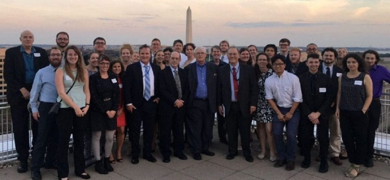
Previous Section
(Claims and Conflicts)
Next Section
(Conclusions)
Abstract and
Table of Contents
List of Images
                                      Sandia NAtional Laboratories


Analysis of Aerial and Satellite Imagery

We analyzed images of each island listed in Table 2 for infrastructure, ongoing activities, and natural phenomena. We searched for manmade and natural changes as well as evidence that could confirm or refute accounts in published articles about specific islands. The image analysis enabled us to assess the technical capabilities and limitations of the various imaging systems that were used, and gauge the likely utility of imaging satellites that are planned for deployment within the next few years.

Mischief Reef

In early 1995, the appropriately named Mischief Reef emerged as a major flashpoint in the South China Sea when China began constructing and occupying buildings on the reef. Filipino fishermen reportedly discovered the Chinese occupation, were detained by Chinese personnel at Mischief Reef, and subsequently notified Philippine authorities after being released.26 Philippine naval and air force reconnaissance confirmed that the Chinese had taken control of the reef located 215 km west of undisputed Philippine territory.27 The Philippine government perceived the Chinese action as a direct challenge to their own sovereignty claim over Mischief Reef.

The Philippine Department of National Defense reported that several Chinese naval ships were sighted in close proximity to the reef, including a Yukan-class amphibious warfare ship and a Dazhi-class submarine support ship.28 As evidence, the Philippines released aerial photos showing Chinese activities in the area. Plate 1 is an aerial photo of an armed Chinese ship that was reportedly at Mischief Reef in early 1995 (Note: the annotations on all plates are based on our image interpretation). Plate 2 shows aerial photos of two armed ships that the Philippines identified as Chinese. Both of these ships were photographed in the spring of 1997 near Philippine-occupied areas in the South China Sea.

In addition to the ship activity, the Philippines presented aerial photos of four permanent building clusters on Mischief Reef that had been built by China.29 Each cluster was constructed on top of steel pylons because the reef submerges at high tide. Plate 3 and Plate 4 show two of the four building clusters in great detail. Acquired a few months after China took control of the reef, the photos show the personnel at the building clusters carefully observing the observation aircraft as it flies by. Both photos also show the deployment of armor shields along the periphery of the building clusters. The Plate 3 inset shows a possibly armed individual behind one of the armor shields facing the observing aircraft.

IRS-1C satellite images of Mischief Reef show the entire landscape as well as the surrounding sea. In both Plate 5 and Plate 6, one can readily see the reef structure, lagoon with a passable opening to the sea, small reef islets inside the lagoon, and the ephemeral beach along the northern periphery.

Acquired 2.5 years after the Chinese occupation, these panchromatic images show significantly less detail than the aerial photos.

The 4 September 1997 IRS-1C image shows the reef with four noticeable blips along the north, south, east, and west perimeter (Plate 5). These blips may be part of the four building clusters described in the media reports on the Chinese occupation. However, it is not possible to be certain about this because the individual buildings within each cluster are not visible. Inside the lagoon, there is a 68 ± 5 meter long feature that could possibly be a naval vessel. Unfortunately, a more definitive identification could not be made because the feature’s shape is blurred and its shadow could not be discerned in the lagoon.31

In the 10 November 1997 IRS-1C image, two of the four blips along the reef periphery could not be seen, but a feature inside the lagoon could be positively identified as a naval vessel (see Plate 6). The Plate 6 inset clearly shows its shape and size. Although the satellite image was too blurred to identify the class of the vessel with certainty, the feature’s measured length of 71 ± 5 meters did eliminate some ship classes from consideration.32 If the vessel was Chinese, it was too small to be a destroyer, frigate, or ballistic missile submarine and too large to be a coastal patrol boat. The vessel was also too small to be either a Yukan-class supply ship (120 meters long) or a Dazhi-class support ship (107 meters long). Both ship classes have been observed at Mischief Reef on earlier occasions. Thus, based on a process of elimination, the imaged ship was probably either a replenishment ship (e.g., Fulin Class), a survey and research ship (e.g., Yannan Class), a cable ship (Yudian Class), or a civilian transport/fishing ship.

Moderate resolution, panchromatic satellite imagery provided a synoptic view of Mischief Reef as well as conclusive evidence of a ship deployment. These initial results suggest that this type of commercial imagery can be used under favorable weather conditions to detect large warships and supply ships. If compared with an overhead imagery database of known ships, the class of the imaged ships may also be identifiable.

However, this same imagery failed to reveal the building clusters shown in the aerial photos. This suggests that higher resolution imagery is required to detect smaller scale features such as the manned outposts shown in Plate 3 and Plate 4. Such high resolution imagery is also likely to be required to determine the nature and purpose of specific activities.

The importance of high resolution imagery was concretely demonstrated in late 1998, when the Philippine government announced renewed Chinese construction on Mischief Reef. The Philippines accused China of a substantial military buildup. China responded that the activity merely involved the repair of existing structures damaged by heavy storms. The conflicting accounts could have lingered on as an unsubstantiated factual dispute, but high-resolution photographic evidence helped to clarify the type of activity that was taking place.

Aerial photos acquired by Philippine reconnaissance show significant construction activity around the existing building clusters (see Plates 7 and 8). Plate 7 shows approximately 40 construction workers laying out the skeletal frame for a new, large concrete structure. The Plate 7 inset shows the five story concrete structure nearly completed just two months later. Plate 8 shows approximately 65 workers building a truss structure adjacent to the existing platforms. The photo also shows shrouds covering portions of the platform and a probable anti-air or anti-ship system surrounded by sandbags.

In addition to the aerial photos of the construction activity, the Philippines released aerial photos of Chinese naval ships that supported the operation. Plate 9 shows two Chinese amphibious warships at Mischief Reef on 7 November 1998. Both of these large ships are Yuting-class equipped with bow doors and helicopter decks. Plate 10 shows three Chinese naval ships positioned next to each other at Mischief Reef on 10 December 1998. The middle ship is a Dayun-class support ship, and the ships on either side of it are Yuting-class.

The high-resolution aerial images of the 1998 construction and ship activity at Mischief Reef clearly show a rapid buildup of fortified structures with logistical support and protection provided by the Chinese PLA navy. The construction of new multi-story, concrete buildings on the reef indicates that the activity went well beyond the repair of existing shelters.

The high-resolution images also show a marked increase in Chinese capability on Mischief Reef. China established an expanded, fortified presence that enables deployed personnel to better withstand harsh weather and resist attack. The fortifications can also be used to project naval power into the surrounding area and serve as a sanctuary for Chinese fishing vessels operating in disputed waters.39 The naval forces that have been observed at the reef demonstrate a capability to quickly reinforce China’s occupation with more personnel, material, and heavy weaponry.

The images of Chinese activities at Mischief Reef provide some working experience on what can and cannot be done with overhead imagery to monitor the South China Sea as a whole. The lessons drawn from such experience can be expanded further by analyzing images of other areas and activities in the South China Sea.

Thitu Island

Thitu Island is the English name for the largest Philippine-occupied island in the South China Sea. Its Filipino name is Pagasa. Philippine forces took control of the island in the 1970s.40 Since China, Taiwan, and Vietnam also claim this relatively large island, the Philippines established a substantial military presence there to reinforce its claim, deter attempts by others to take over the island, and defend itself in case of attack. The approximately 100-man military force on Thitu Island can also be used to project power in other parts of the South China Sea — particularly air power.41

In contrast with the fortified outposts at Mischief Reef, Thitu Island is one of the few islands in the South China Sea with an airfield (known as Rancudo Airfield). Plate 11 shows a Radarsat-1 satellite image of Thitu Island. The radar image provided information on the large-scale infrastructure, but little detail on the small-scale features such as aircraft, vehicles, and buildings. The runway is clearly evident. Built on top of the island’s coral base, it is substantially wider than the island itself. The image also shows the wave barrier at the end of the runway as well as portions of the island’s surrounding reef structure. Scattered throughout the island are a few bright blips that could not be identified, but are most likely vehicles, buildings, and other parts of the island infrastructure.

Aerial photos of Thitu Island show the runway surface composition and significantly more detail on the island vegetation and support infrastructure. Plate 12 shows several buildings surrounded by natural vegetation as well as an observation tower and aircraft parking area. The photo shows that the island’s coral foundation extends well beyond the beaches. Thus, there is available space to enlarge the operations at the island. Indeed, that is reportedly what the Philippines intend to do.

In early 1999, Philippine government officials announced plans to expand and upgrade the infrastructure at Thitu Island. To accommodate a wider array of military and civilian aircraft, it plans to cement the entire airstrip. There are also unconfirmed reports of extending the runway,43 although that may not be necessary because its current length is capable of handling large transport aircraft.

The air operations are planned to be upgraded further with the construction of "temporary" hangars to house Air Force planes.44 These planes are reportedly OV-10 aircraft needed for increased surveillance activities as well as increased visibility of the Philippine Air Force in the South China Sea.45 In addition to the expansion of the air operations, the Philippines also plan to construct a pier, causeway, and base operations center.46

The Philippines plan to open the island for tourism as well.47 To attract visitors to the remote area, they intend to construct at least 10 housing units that would be used by fishermen and tourists. The use of the island by civilians could help defray the cost of the occupation and solidify the Philippines’ claim of sovereignty over the islands in this area.

The facilities at Thitu Island and the announced plans to improve the infrastructure make this site ripe for continued aerial and satellite monitoring. Overhead imagery could be used to determine whether such plans ever get implemented and how the changes would impact existing agreements and declarations. As illustrated in Plate 11 and Plate 12, the moderate-resolution satellite imagery will most likely be useful for detecting and tracking large-scale changes, while one-meter resolution aerial and satellite imagery will probably be most useful for analyzing new construction activity and monitoring the air traffic to and from the island.

Subi Reef

Just 26 kilometers southwest of Thitu Island, China occupies Subi Reef. China took control of the reef in 1988.48 Although it is only above water at low tide, it is centrally located within the archipelago (see Figure 2). It is the northernmost Chinese-fortified position in the Spratlys, and it is relatively close to other strategic islands such as Taiwan-occupied Itu Abu and Philippine-occupied Thitu Island. Consequently, Subi Reef is well suited as a way station and as a monitoring post for observing Taiwanese, Philippine, and Vietnamese activities in the immediate area (see Figure 1 and Figure 2).

Plate 13 is a Radarsat-1 image of Subi Reef. While analyzing the full Radarsat scene of Thitu Island, we accidentally discovered that the satellite had also imaged China’s occupied position on Subi Reef. The discovery was made from the observation of several bright blips inside the reef perimeter. The blips were too coarse to be identifiable, but their bright appearance indicated that the features were distinctively shaped and probably metallic. The high radar backscatter from these objects suggested that these were manmade structures.

Aerial images of Subi Reef confirmed the Radarsat detection. Plate 14 shows two aerial photos of the fortified Chinese position there. Acquired by the Philippine Air Force, the photos show a round platform, a connecting bridge, and a three-story, concrete fort built on top of a raised foundation. The overhead photo also shows four naval guns and a communications dish.

These specific features could not be identified in the Radarsat image because the resolution was too coarse. However, using the aerial photos, it was possible to identify the blips that corresponded with the fort, platform, and bridge. This was done by comparing the orientation of the blips with respect to north to the orientation shown in the overhead aerial photo. From this comparison, the structures shown in the aerial photos were matched with the corresponding blips in the Radarsat image (see Plate 13 inset).

The analysis of Subi Reef demonstrated how image information from different sensor platforms could be combined to provide a clearer overall picture. The satellite image showed the layout and level of activity at the reef while the aerial photos provided details on the fortifications. The satellite image was useful for detecting the structures as part of a wide area sweep while the aerial photos were useful for identifying the "dots" that were detected. Each sensor platform compensated for the principal technical limitations of the other sensor platform.

Commodore Reef

Commodore Reef is located in the southeastern quadrant of the Spratly archipelago (see Figure 2). Located 110 km west of the Philippines’ Palawaan island and 125 km northwest of Malaysia, Commodore Reef is claimed by China, Malaysia, the Philippines, and Vietnam. The Philippines took control of the reef in the 1970s, although one report states that they deserted it in the mid-1980s.49

Commodore Reef was the site of one major incident. In April 1988, the Malaysian navy detained Philippine fishermen operating near the reef. The Philippine government protested the detention, and Malaysia ultimately released the fishermen as a gesture of goodwill. However, they explicitly noted that the release was done without prejudice to Malaysia’s claim over Commodore Reef.50

Plate 15 is an IRS-1C panchromatic image of Commodore Reef. The ‘Figure 8’ shaped reef consists of two, separate lagoons. It is one of the larger reefs in the South China Sea, with portions of it remaining above water at high tide.51 The satellite image shown in Plate 15 shows little detail on human occupation of the reef. Careful examination of the image revealed five distinct blips connected by linear features that could be evidence of manmade structures (see Plate 15 insets). However, because of the coarse resolution of the image, it was not possible to verify the reported Philippine presence on the reef with a high degree of confidence. Nor was it possible to determine whether there were any inhabited sites on the portions of the reef that were obscured by cloud cover (see Plate 15).

The IRS-1C satellite image of Commodore Reef illustrates two strengths and two weaknesses of moderate resolution, panchromatic imagery. It can show the geographic layout of a reef in more detail than existing maps. It can also detect blips that may be evidence of human occupation. On the other hand, it cannot, in itself, provide conclusive evidence of a small-scale military presence, nor can it be used to search for features obscured by clouds.

Alicoa Annie and Yuan Anha

Alicoa Annie (also known as Alicia Annie) and Yuan Anha are two large reefs in the South China Sea that have no known occupants. However, both are in relatively close proximity to other reefs and islands that are occupied by various claimant states. Alicoa Annie is just 56 kilometers south-southwest of Chinese-occupied Mischief Reef. Yuan Anha is less than 75 kilometers from reefs that are occupied by the Philippines, Malaysia, and Vietnam (see Figure 1 and Figure 2).

Although the Spratly conflict has sometimes been intense, Alicoa Annie and Yuan Anha have been relatively peaceful. There have been no documented confrontations at Yuan Anha and one at Alicoa Annie. On 25 March 1995, the Philippine navy captured four Chinese fishing boats near Alicoa Annie and arrested 62 fishermen.52 The detention of the Chinese fishermen took place just two months after China took control of Philippine-claimed Mischief Reef. The arrests were consistent with a pattern of seizing fishing vessels of a claimant state shortly after it occupies another Spratly reef or island.

Plate 16 and Plate 17 are IRS-1C panchromatic images of Alicoa Annie and Yuan Anha. Both were acquired in March 1998 and both are almost completely cloud free. Alicoa Annie and Yuan Anha are appreciably larger in size than the other selected islands and show no evidence of human occupation whatsoever.

Careful examination of Plates 16 and 17 failed to reveal any blips, paths, or structures that could be attributed to the physical occupation of the reefs. This suggests that moderate-resolution images may have limited utility not only for detecting possible inhabited structures, but also for verifying the absence of such structures on disputed reefs.53


Previous Section
(Claims and Conflicts)
Next Section
(Conclusions)
Abstract and
Table of Contents
List of Images
                                      Sandia NAtional Laboratories

26 William Branigin, "China Takes Over Philippine-Claimed Area of Disputed Island Group," The Washington Post, 11 February 1995, p. A18. return to article
27 "Philippine Navy Sends Ship to Disputed Shoal," Reuters World Service, 2 February 1995. return to article
28 Branigin, p. A18. It is possible the Yukan-class ship was actually a Yuting-class amphibious warship. Both types of ships have similar profiles, and both operate in the South China Sea. return to article
29 Branigin, p. A18. return to article
30 Capt. Richard Sharpe RN, editor, Jane's Fighting Ships: 1995-1996 (London: Butler and Tanner Limited, 1995), p. 140. return to article
31 The feature's shadow could not be seen because it blended with the dark lagoon water. The cloud shadows could not be seen in the lagoon either. The high sun elevation (69o) also reduced the shadow's size. return to article
32 Sharpe, Jane's Fighting Ships: 1995-1996, pp. 114-142. return to article
39 There has already been one publicized case where a Chinese fishing vessel has reportedly fled to Mischief Reef to elude the Philippine Navy. "China Demands Fishers' Release," Manila Times, 2 December 1998. return to article
40 Daniel Dzurek, "The Spratly Islands Dispute: Who's On First?," Maritime Briefing, Vol. 2, No. 1, 1996, p. 21. return to article
41 Raffy Jimenez, "Coping in Sweet, Sad Spratlys," The Manila Times, 13 January 1999. return to article
43 Johnna Villaviray, "RP Eyes Expansion of Spratlys Facilities," The Manila Times, 25 February 1999. return to article
44 Raffy Jimenez, "China Aircraft on Frequent Mischief Flights," The Manila Times, 19 December 1999. return to article
45 Ibid. The OV-10 aircraft was built by Rockwell for the US Marine Corps. It is widely used for reconnaissance, but it also can be configured as a fighter-bomber. Jane's All the World's Aircraft 1986-87 (London: Jane's Publishing Company Limited, 1986), pp. 492-493. return to article
46 Villaviray, "RP Eyes Expansion of Spratlys Facilities." return to article
47 "Philippines Plan to Open Spratly Island to Tourism," Asia Pulse, 18 February 1999. return to article
48 Mark Valencia, "The Spratly Islands: Dangerous Ground in the South China Sea," Pacific Review, Vol. 3, No. 2, pp. 438-443. return to article
49 Mark J. Valencia, Jon M. van Dyke, and Noel Ludwig, Sharing the Resources of the South China Sea (The Hague: Martinus Nijhoff Publishers, 1997), p. 228. return to article
50 Dzurek, "The Spratly Islands Dispute," p. 25. return to article
51 Valencia et al., p. 228. return to article
52 Pastor, "Philippines Holds Four Chinese boats in Spratlys," Reuters World Service, 25 March 1995. return to article
53 If camouflage is used to blend the appearance of structures with the surrounding reef, high resolution imagery or radar imagery would most likely be required to detect such structures or verify the absence of such structures. return to article